Uncover the dynamic geological story of the United States with an insightful look at its volcanoes in the us map. This essential guide helps you navigate and understand the significant volcanic activity across American states, from the famous peaks of the Pacific Northwest to the vast fields of Alaska and the iconic Yellowstone supervolcano. Discover where these powerful geological features are located, why they are monitored, and what their presence means for residents and visitors alike. Understanding the volcanoes in the us map is crucial for appreciating America's ever-changing natural wonders. This informational resource provides key insights for anyone interested in Earth science and safety, making complex geological data accessible and engaging. Explore the fiery heart of America and its incredible volcanic past and present.
How many active volcanoes are in the US?
The United States currently has approximately 169 potentially active volcanoes. This count includes those in Alaska, Hawaii, and the continental US. The U.S. Geological Survey (USGS) monitors these volcanoes closely for any signs of unrest. Many are located in remote areas, particularly in Alaska's Aleutian Arc.
What state in the US has the most volcanoes?
Alaska has the most volcanoes in the United States, with over 100 potentially active ones. Many of these are found along the Aleutian Arc, which is part of the Pacific Ring of Fire. This region experiences frequent eruptions and constant seismic activity, making it a crucial area for volcanic research.
Is there a supervolcano in the US?
Yes, the most famous supervolcano in the US is the Yellowstone Caldera, located primarily in Wyoming. While it doesn't look like a typical volcano, its massive underground magma chamber has erupted cataclysmically in the geological past. The USGS monitors Yellowstone closely for any changes, ensuring public safety and scientific understanding.
What is the biggest volcano in the US?
Mauna Loa in Hawaii is considered the largest active volcano on Earth by mass and volume. It rises over 13,680 feet above sea level and extends another 17,000 feet to the seafloor. Its immense shield shape covers half of Hawaii Island, making it a truly colossal feature on the volcanoes in the us map.
Are there any volcanoes on the East Coast of the US?
While the East Coast of the US is not currently home to active volcanoes, it does have remnants of ancient volcanic activity. These extinct volcanoes are millions of years old and are now deeply eroded. The Appalachian Mountains, for example, show evidence of past geological events, but no active volcanoes exist there today.
Which US volcanoes are most dangerous?
The volcanoes considered most dangerous in the US are typically those with a history of explosive eruptions, located near populated areas, or those designated as supervolcanoes. These include Mount Rainier in Washington, Kilauea in Hawaii, and the Yellowstone Caldera. These volcanoes require continuous monitoring due to their potential impact.
When we explore the volcanoes in the us map, we uncover a fascinating geological story. The United States is home to a surprising number of these majestic and powerful formations, spread across various regions. Understanding where these volcanoes are, what types they represent, and why they are important helps us appreciate our dynamic planet. This article will guide you through the key volcanic areas, highlighting their significance and current status. Knowing the volcanoes in the us map is essential for residents and curious minds alike.
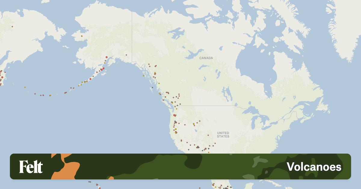
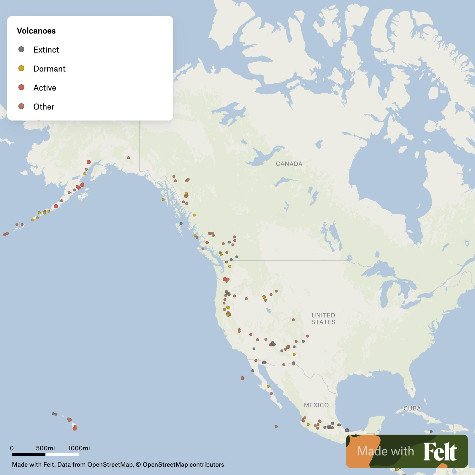
The Western United States is a hotspot for volcanic activity. The Cascade Range, stretching from northern California through Oregon and Washington, features iconic peaks. Mount St Helens and Mount Hood are prime examples of volcanoes in the us map in this region. These stratovolcanoes are known for their explosive potential, drawing significant scientific attention.
Alaska holds the vast majority of active volcanoes in the us map. The Aleutian Islands alone are dotted with dozens of active vents. This remote chain is part of the Pacific Ring of Fire, a testament to powerful tectonic forces. The volcanoes here are constantly monitored due to their frequent eruptions and potential impact on air travel.
Hawaii offers a different kind of volcanic experience, showcasing shield volcanoes. Kilauea and Mauna Loa are among the most active volcanoes globally. Their effusive eruptions create dramatic lava flows, continuously shaping the islands. These natural wonders are a highlight on any volcanoes in the us map exploration.
Yellowstone National Park hosts one of the world's most famous supervolcanoes. While not visibly cone-shaped, its massive caldera underlies much of the park. The Yellowstone supervolcano is a critical feature on the volcanoes in the us map for its immense scale. Geologists closely monitor its hydrothermal activity and ground deformation, ensuring public awareness.
Other notable volcanic fields also exist across the US, though they are less recognized. Areas like the Long Valley Caldera in California and the Newberry Volcano in Oregon contribute to the diverse volcanoes in the us map. Even parts of Arizona and New Mexico have remnants of past volcanic activity. These areas demonstrate the widespread nature of US volcanic history.
Overview of US Volcanic Regions Volcanoes in the US Map
| Region | Notable Volcanoes | Activity Type | Key Characteristics |
|---|---|---|---|
| Pacific Northwest (Cascades) | Mount St Helens, Mount Hood, Mount Rainier | Explosive stratovolcanoes | Part of the Pacific Ring of Fire, significant hazard potential |
| Alaska (Aleutian Islands) | Okmok, Augustine, Pavlof | Highly active, diverse eruption styles | Over 100 volcanoes, remote, impacts air travel |
| Hawaii | Kilauea, Mauna Loa, Hualalai | Effusive shield volcanoes | Continuous lava flows, active island building |
| Wyoming (Yellowstone) | Yellowstone Caldera | Supervolcano, hydrothermal | Massive caldera, significant seismic and geothermal activity |
| California (Eastern) | Long Valley Caldera, Mono-Inyo Craters | Explosive to effusive | High-risk calderas, geothermal features |
What Others Are Asking? Volcanoes in the US Map
How many active volcanoes are in the US?
The United States currently has approximately 169 potentially active volcanoes. This count includes those in Alaska, Hawaii, and the continental US. The U.S. Geological Survey (USGS) monitors these volcanoes closely for any signs of unrest. Many are located in remote areas, particularly in Alaska's Aleutian Arc.
What state in the US has the most volcanoes?
Alaska has the most volcanoes in the United States, with over 100 potentially active ones. Many of these are found along the Aleutian Arc, which is part of the Pacific Ring of Fire. This region experiences frequent eruptions and constant seismic activity, making it a crucial area for volcanic research.
Is there a supervolcano in the US?
Yes, the most famous supervolcano in the US is the Yellowstone Caldera, located primarily in Wyoming. While it doesn't look like a typical volcano, its massive underground magma chamber has erupted cataclysmically in the geological past. The USGS monitors Yellowstone closely for any changes, ensuring public safety and scientific understanding.
What is the biggest volcano in the US?
Mauna Loa in Hawaii is considered the largest active volcano on Earth by mass and volume. It rises over 13,680 feet above sea level and extends another 17,000 feet to the seafloor. Its immense shield shape covers half of Hawaii Island, making it a truly colossal feature on the volcanoes in the us map.
Are there any volcanoes on the East Coast of the US?
While the East Coast of the US is not currently home to active volcanoes, it does have remnants of ancient volcanic activity. These extinct volcanoes are millions of years old and are now deeply eroded. The Appalachian Mountains, for example, show evidence of past geological events, but no active volcanoes exist there today.
Which US volcanoes are most dangerous?
The volcanoes considered most dangerous in the US are typically those with a history of explosive eruptions, located near populated areas, or those designated as supervolcanoes. These include Mount Rainier in Washington, Kilauea in Hawaii, and the Yellowstone Caldera. These volcanoes require continuous monitoring due to their potential impact.
FAQ about Volcanoes in the US Map
What are volcanoes in the US map?
Volcanoes in the US map are geographical representations showing the locations of active, dormant, and extinct volcanoes across the country. They highlight major volcanic regions like the Pacific Northwest, Alaska, Hawaii, and Yellowstone. These maps are crucial for understanding geological hazards and planning.
Who monitors volcanoes in the US?
The U.S. Geological Survey (USGS), specifically its Volcano Hazards Program, monitors volcanoes in the US. They use a network of seismic sensors, GPS, and satellite imagery to detect changes. This dedicated monitoring helps to provide timely warnings and assess potential risks to communities.
Why are there so many volcanoes in the US?
The abundance of volcanoes in the US is primarily due to its location along major tectonic plate boundaries. The Pacific Ring of Fire, which runs through Alaska and the Pacific Northwest, causes intense subduction and volcanic activity. Hawaii's volcanoes are formed by a hotspot, illustrating diverse geological processes.
How do US volcanoes impact daily life?
US volcanoes can impact daily life through ashfall affecting air travel and agriculture, lava flows destroying infrastructure, and lahars (mudslides) threatening communities. Even non-eruptive activity like gas emissions or earthquakes can be significant. Monitoring helps mitigate these potential disruptions.
Volcanoes in the US map reveal activity in Alaska, Pacific Northwest, Hawaii, and Yellowstone. The US boasts over 160 volcanoes, including active and dormant ones. Monitoring volcanic activity is vital for public safety and scientific research. Understanding the distribution of volcanoes helps inform hazard preparedness. Yellowstone is a supervolcano, though its eruption risk is low. Hawaii's Kilauea is among the world's most active volcanoes.



Feed A Cold Starve A Fever Fact Vs Fiction News Usa Today Active Volcano Map2 2026 02 10 . Where Are US Volcanoes Located A National Map Guide 2630ca . US Volcanoes A Fiery Landscape Current . Where Are US Volcanoes Located A National Map Guide N180517 Us Volcanoes . How Many Volcanoes Are In The Mainland Us At Zoe Mehaffey Blog


US Volcanoes A Fiery Landscape Volcanoes In The Us Map . Us Volcanic Activity Map Volcano Activity Map GHOK 169 Figure5.1 1 . 18 Volcanoes In The US Considered To Be Very High Threats 76999751 12671369 Image A 11 . US Volcanoes A Fiery Landscape Explored Usa Volcano Map 768x521 . 13 U S Volcanoes And Current Activity Alerts Maps Volcanoes And US Volcanoes And Current Activity Alerts Maps Volcanoes And Alert Levels USGS.ppm



US Volcanoes A Fiery Landscape Explored . Extinct Volcanoes In Usa Original 9684578 1 . Where Are US Volcanoes Located A National Map Guide Quakes At Volcanoes 22012026 . Printable Map Of Volcanoes In The Us Printable US Map Us Volcano Map Active Eruptions Geological Data And Lava Flows . Map Of Active Volcanoes Worldwide ESA Earth S Most Active Volcanoes MapMaker Volcanoes


US Volcanoes A Fiery Landscape Explored Interactive . Volcanic Activity Worldwide 19 Feb 2026 Santiaguito Volcano Pacaya Active Volcano Map2 2026 02 17 . Volcanic Activity Worldwide 14 Apr 2026 Fuego Volcano Semeru Ibu Active Volcano Map2 2026 04 14 . Volcanic Activity Worldwide 21 Feb 2026 Santiaguito Volcano Pacaya Active Volcano Map2 2026 02 16 . Volcanic Activity Worldwide 17 Mar 2026 Fuego Volcano Shiveluch Ibu Active Volcano Map2 2026 03 13


Global Volcanism Program Smithsonian USGS Daily Volcanic Activity . Volcano Earthquake Report For Tuesday 24 Mar 2026 Quakes At Volcanoes 24032026 . Volcano Earthquake Report For Monday 30 Mar 2026 Quakes At Volcanoes 30032026 . Volcano Earthquake Report For Tuesday 17 Feb 2026 Quakes At Volcanoes 17022026 . Volcano Earthquake Report For Friday 30 Jan 2026 Quakes At Volcanoes 30012026


Volcano Earthquake Report For Wednesday 25 Mar 2026 Quakes At Volcanoes 25032026 . Volcano Earthquake Report For Monday 23 Mar 2026 Quakes At Volcanoes 23032026 . Volcano Earthquake Report For Thursday 1 Jan 2026 Quakes At Volcanoes 01012026 . Volcano Earthquake Report For Sunday 26 Apr 2026 Quakes At Volcanoes 26042026 . Map Of Extinct Volcanoes In Britain



Volcano News Eruptions At Shiveluch Taal More March 14 2026 Active Volcano Map2 2026 03 14 . US Volcano Map United States Volcano Map Usa Volcano Map . Volcano Earthquake Report For Saturday 21 Mar 2026 Quakes At Volcanoes 21032026 . Volcano Earthquake Report For Tuesday 28 Apr 2026 Quakes At Volcanoes 28042026